Select NOAA-NWS Forecast Office Text Products
(Product availability varies with seasons, forecast office, and weather.)
Hazardous Weather Outlook for State College, PA
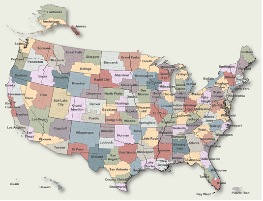
To Select Another NWS Office Click on Map or Choose from List
|
| Select Forecast Office: | Select Product: |
950 FLUS41 KCTP 211823 HWOCTP Hazardous Weather Outlook National Weather Service State College PA 223 PM EDT Tue Jul 21 2026 PAZ004>006-010>012-017>019-024>028-033>037-041-042-045-046-049>053- 056-057-063>065-221830- Warren-McKean-Potter-Elk-Cameron-Northern Clinton-Clearfield- Northern Centre-Southern Centre-Cambria-Blair-Huntingdon-Mifflin- Juniata-Somerset-Bedford-Fulton-Franklin-Tioga-Northern Lycoming- Sullivan-Southern Clinton-Southern Lycoming-Union-Snyder-Montour- Northumberland-Columbia-Perry-Dauphin-Cumberland-Adams-York- 223 PM EDT Tue Jul 21 2026 This Hazardous Weather Outlook is for central Pennsylvania. .DAY ONE...This afternoon and tonight. Scattered severe thunderstorms with damaging winds 60 mph or greater are expected from the mid afternoon through the evening hours. An isolated tornado and large hail exceeding 1 inch in diameter is possible in the strongest storms. Some of the storms may produce torrential downpours that could result in a few areas of flash flooding. .DAYS TWO THROUGH SEVEN...Wednesday through Monday. The probability for widespread hazardous weather is low. .SPOTTER INFORMATION STATEMENT... Spotters are encouraged to report significant hazardous weather. $$ PAZ058-059-066-221830- Schuylkill-Lebanon-Lancaster- 223 PM EDT Tue Jul 21 2026 ...TORNADO WATCH 507 IN EFFECT UNTIL 9 PM EDT THIS EVENING... This Hazardous Weather Outlook is for central Pennsylvania. .DAY ONE...This afternoon and tonight. Please listen to NOAA Weather Radio or go to weather.gov/StateCollege on the internet for more information about the following hazards. Tornado Watch. Scattered to numerous severe thunderstorms with damaging winds 60 mph or greater are expected from the mid afternoon through the evening hours. A few tornadoes and large hail exceeding 1 inch in diameter are also possible. Some of the storms may produce torrential downpours that could result in widely scattered areas of flash flooding. .DAYS TWO THROUGH SEVEN...Wednesday through Monday. The probability for widespread hazardous weather is low. .SPOTTER INFORMATION STATEMENT... Spotters are encouraged to report significant hazardous weather. $$ |
Previous Hazardous Weather Outlooks may be found at
NWS State College, PA (CTP) Office Hazardous Weather Outlooks.
(Click 'Previous Version' there to view past versions successively.
Some may differ only in time posted.)
Products Courtesy of NOAA-NWS
NWS Information Parsing Script by Ken True at Saratoga Weather - WFO and Products Scripts by SE Lincoln Weather.
Mapping by Curly at Michiana Weather and by Tom at My Mishawaka Weather.