No Warnings, Watches, or Advisories

NWS Northeast Regional Radar WU North East Satellite
Radar/Satellite images courtesy of NOAA/NWS and Weather Underground.
spacer
Updated: @ 21-Jul-2026 10:45am - next update at 12:00am  
Summary / Temperature Wind Rain Outlook
Day time Day time
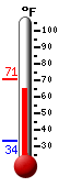
Currently: 80.0, Max: 81.4, Min: 74.2 80°F
Colder 0.8°F than last hour.

---

Feels like: 84.0°F

24-hr difference
3.4°FWarmer 3.4°F than yesterday at this time.
  Today Yesterday
High: 81.4°F
9:25am
83.3°F
3:38pm
Low: 74.2°F
6:50am
58.5°F
5:55am
 Calm SSE
0
Gust:
0 mph
0 Bft - Calm
Today: 13 mph 12:04am
Gust Month: 35.0 mph July 5
Rain Today: 0 in
Rain Rate (/hr): 0 in
Rain Yesterday: 0 in
Storm Rain: 0 in
This Month: 3.31 in
Season Total: 18.57 in
7 rain days in July.
Tonight

Tonight: Showers And Thunderstorms Likely
Showers And T-Storms Likely
Humidity & Barometer Almanac Moon
Humidity: 79 % Increased 2.0% since last hour.
Dew Point: 72.9°F  
Barometer: 29.747 inHg Falling 0.01  inHg/hr
Baro Trend: Steady
Sunrise: 6:00am
Sunset: 8:36pm
Moonrise: 2:05pm
Moonset: 11:50pm
Waxing Gibbous
Waxing Gibbous, Moon at 7 days in cycle
52%
Illuminated
UV Index Forecast UV Index Forecast
21-Jul-2026
8.8     Very High 
22-Jul-2026
8.2     Very High 
 NWS Weather Forecast  - Outlook: Today & Tonight
Today

Today: Chance Showers And Thunderstorms
Chance Showers And T-Storms

Hi 86 °F
NWS forecast: A chance of showers and thunderstorms before 3pm, then showers and thunderstorms likely between 3pm and 4pm, then showers and thunderstorms likely. Some of the storms could be severe and produce heavy rain. Mostly cloudy, with a high near 86. Southwest wind around 10 mph. Chance of precipitation is 70%. New rainfall amounts between a quarter and half of an inch possible.
Davis VP+ forecast: Mostly cloudy and cooler, precipitation possible within 12 hours, possibly heavy at times, windy.
 
Tonight

Tonight: Showers And Thunderstorms Likely
Showers And T-Storms Likely

Lo 68 °F
NWS forecast: Showers and thunderstorms likely before 7pm, then a chance of showers and thunderstorms between 7pm and 10pm, then a chance of showers and thunderstorms between 10pm and 4am. Some of the storms could be severe and produce heavy rain. Mostly cloudy, with a low around 68. Southwest wind 5 to 9 mph. Chance of precipitation is 60%. New rainfall amounts between a quarter and half of an inch possible.
Animated icons courtesy of www.meteotreviglio.com.